I woke up around 7 o’clock local time. The plan was to be airborne at 9 at the latest. I packed my gear and put everything I might need in the plane. I left some things behind to make the airplane lighter. No tow-bar, no souvenirs, no sleeping bag. Half of the stuff was put in the Eureka airport building, the other part stayed in my tent. I went to the weather station to get some breakfast. Because it was a Sunday (I lost track of time), most people were sleeping in. I tried to call the weather forecaster at PCSP, but he was busy and asked me to call back half an hour later. So I waited anxiously. Would this be the day I’d fly over the North Pole ? Or would I just spend it waiting for better weather ? Or would this be the day I decided to just turn back and give up on it ? I stared out of the window. At least the 10 NM I could see had a beautiful blue sky. The forecast for Eureka itself was very good all day. CAVOK and light winds.
Half an hour later, I called back. The friendly PCSP meteorologist answered the phone and started to work on the forecast. Because the connection with the server that contained the satellite images was rather slow, he asked to call back again in 15 minutes. So after 14 minutes and 50 seconds I dialed the number again. The forecast was very similar to the one I got the day before. The area around Eureka was cloud free. From 200 NM a little bit of scattered high clouds could start forming. In an area of 50 NM around the pole, I could expect low clouds or fog. Possibly around 400ft. Maybe higher, maybe lower. Around the coast line, some fog was to be expected but only for a few miles, so no need to worry about that. For the next days, no improvements were expected, it might even take a turn for the worst. I got the feeling it was a bit a “now or never” situation, so I crossed my fingers and hoped that I would be able to see the pole. And if not, at least I would have flown over it.
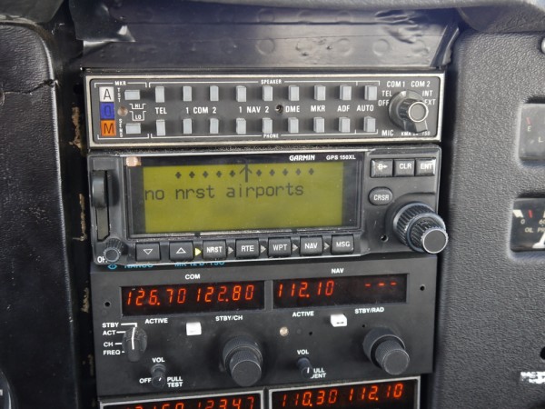
The decision was made to fly. Next part: file a flight plan by phone. They always ask the same questions, but the answers were a little bit more different this time.
“Edmonton Center, good morning”
– “Good morning, I’d like to file an IFR flight plan”
“Ok, go ahead”
– “It will be a local flight CYEU – CYEU via the North Pole, 90° North”
“Airplane type ?”
– “Cessna 172”
[… silence…]
“Estimated time on route ?”
– “12 hours”
“Endurance ?”
– “16 hours”
[…]
“Thank you sir, have a nice flight”‘
I walked back to my airplane. I did a thorough preflight check, removed the tie downs from the plane while keeping the hooks firm in the ground for when I returned. By now, it was around 10:30 and the people were all moving towards the weather station for the typical Sunday brunch. I added a quarter of oil in the engine, put on the immersion suit and squeezed myself back into the airplane. The more you try to squeeze yourself into the plane, the easier it gets. I looked around the cockpit, and made sure everything was safely secured. All the maps were within reach, the Personal Locator Beacon was hanging around my neck. The spot device was looking for a signal. The satellite phone within reach.
The anxiety from the night before had disappeared and was replaced by a sense of adventure. By the feeling of turning something surreal into reality. I looked at the sky. Checked the apron. Left is clear. Right is clear. Ignition. And the engine was running. Since I was parked at the end of the active runway I needed to backtrack on the gravel runway. This gave me ample opportunity to perform the preflight check. This included checking the ferry tank pumps. All looked normal. I lined up on the runway and applied full throttle once again. The airplane was raring to go and so was I. I could see some people at the scientist camp looking at me. I was hoping I would see them again in 12 hours.
Once airborne I turned heading North. That was one advantage of this flight, it was quite easy to remember which heading to turn. I relied on the GPS to set my gyroscopic compass. The magnetic compass was getting very sluggish and unreliable. When I checked, I flew a magnetic heading of 090°.
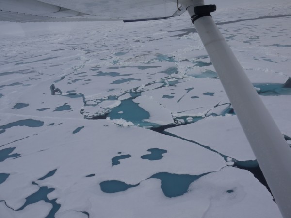
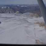
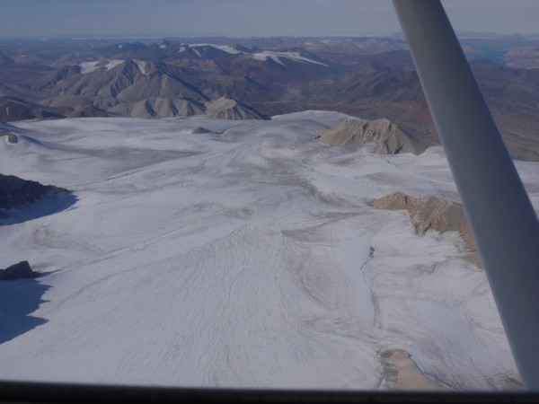
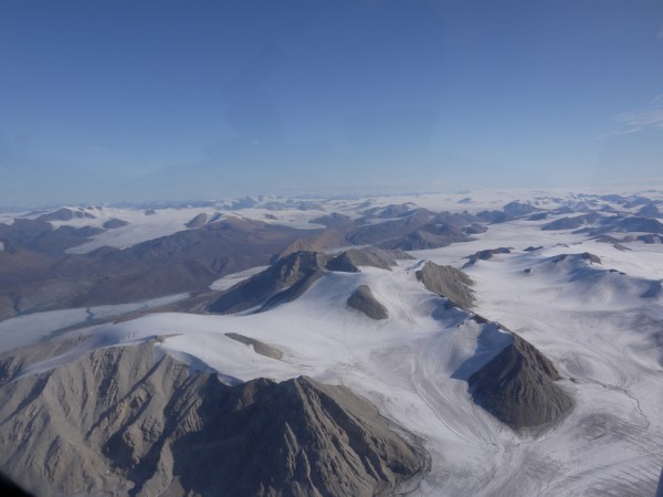
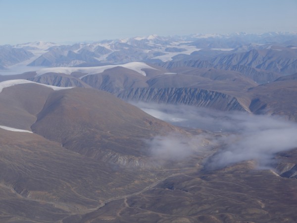
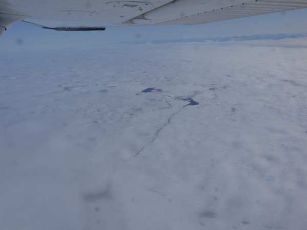
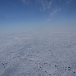
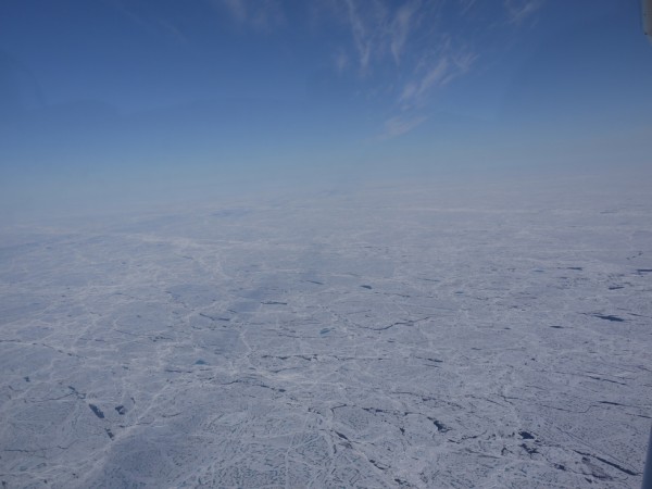
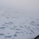
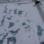
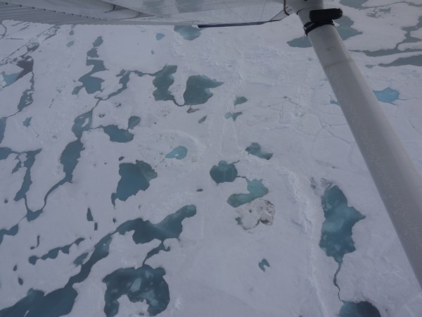
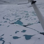
The first two hours of the flight I was still over land. It was a bit of a repetition of the day before: mountains with glaciers. Only difference: they were a little higher and so much more beautiful. I could see the fog from the coast trying to conquer the mountains. First the valleys were covered in the steamy fog, then the lower heights and finally the glaciers. Always getting higher and higher, until only the tops remained visible. When the tops disappeared, I was crossing the coast line. At the shore, only a few miles of water were remaining. Barely visible under another layer of fog. When the water disappeared, so did the fog. It made room for a beautiful Arctic Ocean. It was covered for 95% with flat ice. Between the ice were pockets of water. Some had a dark blue color, indicating that these were real cracks, which means you’d sink to the bottom of the ocean if you would dive in there. The others were kind of a greenish blue, with less sharp edges. These were little lakes/puddles in the ice due to the surface melt. You could swim in these without sinking to the ocean. In theory.
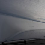
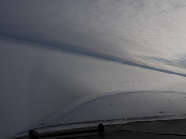
Soon, all of the land disappeared and only the white ice was visible. Ice everywhere. Some very thin high altitude clouds and a beautiful sun. I was flying over the ice for 2 hours when I noticed the ice started to disappear. Clouds were forming. Every now and then, the clouds would become very thin which allowed me to take a peek. The ice was still there, which was nice to know if the engine would decide to quit. When I headed North, it got closer to the low pressure area, so every half an hour I cross checked my altimeter with the GPS indicated altitude.
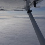
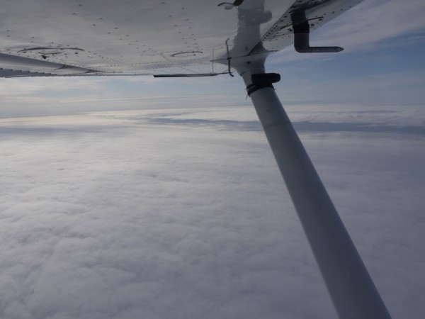
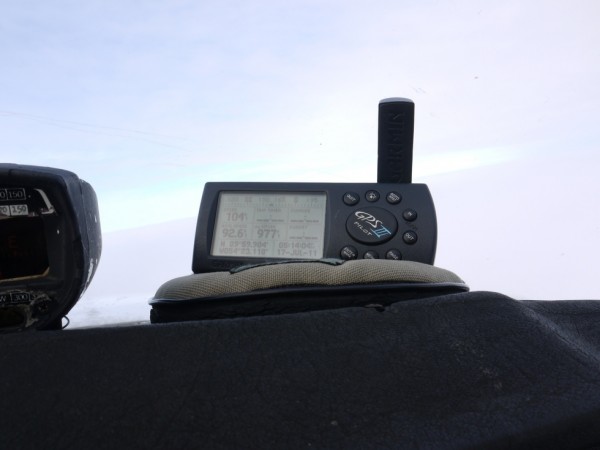
The hours passed by. The EET was soon expressed in minutes instead of hours. The closer I got, the thicker the layer of clouds became. A second higher layer of clouds started to form. The visibility was still very good and there was no ice forming on the wings. The impatience and eagerness to reach the destination started to grow. I checked every gauge and every indicator in the cockpit twice every minute and started my descend to 2000 ft. The minutes started to pass by extremely slowly. Until that moment that the GPS indicated the distance in single digits. 9NM to go… 8 NM … 7 … 6 …. Careful, maintain the track, the longitude indication is very sensitive here. 5 … 4 … 3 … 2 … back to 3 (watch the heading!) … 2 … 1. I was now flying within a 1 NM radius of the geographical North Pole.
Above the clouds, at 2000 ft, I had a beautiful sight at the sun, and I couldn’t see the Pole. I could see a very faint glimpse of the surface, so I decided to try and descend below the cloud base. I dove into the clouds, and a little bit of ice started to form. The surface became clearer and sharper with every feet I descended, so I was not worried of crashing into the water. At 400 ft, I was out of the clouds and I saw the surface in front of me. The clouds must have contained fresh snow and freezing temperatures, because the little puddles in the surface were frozen again, and the surface was covered in a thick layer of fluffy snow. Before that moment I was still considering landing on the pole. An experienced Pole traveler told me that the ice would probably be thick enough to land a C172, but the challenge would be to find a piece of ice unaffected by the surface melt. Turns out he was right.
Tempting faith by trying a landing on wheels on a freshly snowed surface with melted ice everywhere was a bit too risky, even for me. I forgot that idea, and tried to pinpoint the exact location of the Pole. I crossed all 360° meridians in 3 minutes while flying at 300ft with Kenny Loggins’ “Danger Zone”(Top Gun) blasting through my headset.
So that’s how on the 17th of July 2011, at 21.25 GMT, a little Cessna 172 was flying over the geographic North Pole, all alone, in a vast white emptiness, more than 400 NM away from the nearest airport.
-
- Take-off for the North Pole flight
-
- Mountains north of Eureka
-
- Last mountains out of the fog
-
- Creeping fog
-
- Dissolving clouds over the ice
-

- Stating the obvious
-
- Beautiful scenery part 15809
-
- Clouds forming in the vicinity of the Pole
-
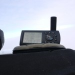
- Over the North Pole!
-
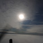
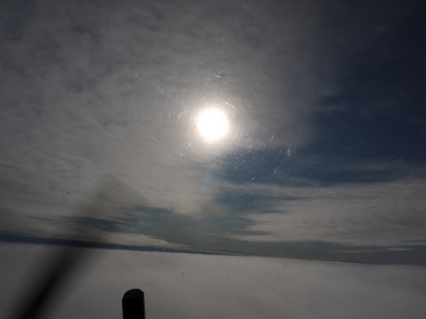
- The sun at 90°N
-
- Diving back through the clouds
-
- Circling the Pole

-
- Where is Santa Claus ?
-
- Lower, lower...

-
- The Geographical North Pole @ 400ft