Welcome to Fly The Impossible

Day 16: Murphy Strikes

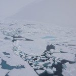
Full of energy I woke up  around 10 local time. The weather station manager was chatting with some scientist just on the outside of the tent. I looked around and made sure I wasn’t dreaming. I was still feeling the effects of the adrenaline.  Once I was up, the scientists told me a group of them would be leaving today as well on a chartered Kenn Borek Air flight. I started packing my stuff, and settled the bill with the manager. I filed another flight plan, my first south bound flight plan since the beginning of the trip. A little sad that it was about to end, but mainly happy that I achieved my goal, I prepared my plane. Of course there was a mandatory photo shooting session before I could leave.

I put the remaining fuel of the barrel into the wings, and collected all the useless stuff I left behind the day before from the airport building/shed.  I squeezed everything back in the plane, made sure it was stable. While doing this, the chartered airplane landed. The scientist were driving around on one of the cool ATV’s and were performing some last minute research (or were just having fun, I couldn’t tell, but knowing scientists, it’s probably a bit of both). I double and triple checked everything to make sure I didn’t leave anything behind since I wouldn’t be coming back anytime soon… Continue reading

Day 15: North Pole Flight (II)

There I was, circling around the pole. After 4 turns, calculating my route was a bit too much, and panel mounted GPS failed and started looking for satellite reception. My portable GPS, which was only showing my current position, and was not calculating any route, kept working just fine. I didn’t even have to turn on my 3rd GPS system. I kept circling, and crossed all meridians in the process. A wonderful feeling! After 15 minutes I was satisfied with my circling and flying over the pole, and I started climbing to higher altitudes. I waved goodbye to the Pole, and climbed through the foggy clouds, towards the sun. Putting a new route or waypoint in the GPS didn’t really seem like a good idea, so I based myself upon the gyroscopic compass –which was aligned with the 86°th meridian. After 2 weeks of flying North, I started heading South again. I had the feeling the adventure was over, but reality soon awoke me from that dream. I still had to fly for 6 hours to get back to Eureka.

Just to be on the safe side (and because I made some steep turns over the pole – for the pictures you know), I crosschecked the gyroscopic compass with the position of the sun. I also saw the longitude was more or less constant on the portable GPS, while the latitude was decreasing. Everything was looking good. The panel mounted GPS was still searching for a signal. Continue reading

Day 15: North Pole Flight (I)

I woke up around 7 o’clock local time. The plan was to be airborne at 9 at the latest. I packed my gear and put everything I might need in the plane. I left some things behind to make the airplane lighter. No tow-bar, no souvenirs, no sleeping bag. Half of the stuff was put in the Eureka airport building, the other part stayed in my tent. I went to the weather station to get some breakfast. Because it was a Sunday (I lost track of time), most people were sleeping in. I tried to call the weather forecaster at PCSP, but he was busy and asked me to call back half an hour later. So I waited anxiously. Would this be the day I’d fly over the North Pole ? Or would I just spend it waiting for better weather ? Or would this be the day I decided to just turn back and give up on it ? I stared out of the window. At least the 10 NM I could see had a beautiful blue sky. The forecast for Eureka itself was very good all day. CAVOK and light winds. Continue reading

Day 14: Eureka!

Randy made me a wonderful breakfast, and Jane (the reporter) joined me on the ride to the airport. I first went to visit the meteorological forecast service people of the polar continental shelf program. I traded chips and salsa sauce for a very detailed forecast. CAVOK all the way to Eureka. I was more interested in the forecasts for the North Pole the next day. It took a while to download the satellite images of the pole. Once completed, the scientist took a thorough look, and explained that there was a high pressure ridge creating good weather, but also low clouds about 50 NM from the pole itself. The weather would be stable for about a week, but deteriorate slowly every day. I promised I would call him the next day for an update. When I would fly over the pole, I’d want to see it. So good weather was somewhat mandatory. I added a phone number to my collection to call the next day, and went to visit the radio guy. Continue reading

Day 13: Ice

I woke up quite early today and checked the weather. The plan was to reach Resolute Bay (CYRB) by the end of the day. This would be almost an 8 hour flight, so I felt more comfortable having an alternate airport, which was Taloyoak (CYYH), located half way between Rankin Inlet and Resolute Bay. The weather forecast was very good at the start (a few high clouds) and the destination (CAVOK) with very light winds. In between, I could expect quite a bit of clouds I needed to cross. There would be two cloud layers, one quite low around 2000 ft and a higher one around 7000 ft. The freezing level today was forecasted to be around FL100, well above my intended flight path.

With a mental “all systems go”, I ate a quick breakfast. The hostess called me a cab to drive me to the airport. Rankin Inlet is quite a small town (+- 2400 people), yet had a surprisingly efficient taxi system. All distances were small, which resulted in one fixed price for a cab: 5 dollar anywhere you wanted to go. Surprisingly cheap compared to the accommodations. Continue reading

Day 12: Fueling Arctic Style!

The next morning started with a beautiful sky. My friendly hosts took me to a nice little breakfast place where I had to brush up all the terms for all those different kinds of eggs. I enjoyed my sunny-side-up egg and gained all the strength necessary for my next flight. It would be short 2 hour flight, so no flight plan was filed. I was thinking there would be enough traffic following available. Which of course, there was not.

My first take-off from a gravel runway was uneventful. I managed not to damage the airplane, and flew over Churchill city, waving my hosts goodbye. I crossed a little bit of water and followed the shoreline for almost the entire 2 hours. While flying, I was constantly hopping frequencies in an idle attempt to maintain radio contact if the need arised. I had been told this was prime polar bear season, so I was very eager to see these creatures in real life. They should be collecting at the shore, waiting for the big Hudson Bay to freeze over again, so I flew at 2000ft over the shore. My disappointment was enormous when I arrived at Rankin Inlet (CYRT) without seeing even one polar bear! Continue reading

Day 11: Fire!

Today I once again realized the emptiness and isolation was once again getting closer and closer. The lines on the map were not crossing any road or cities anymore. The next destination, Churchill (CYYQ), was only connected to civilization by one railroad, a harbor, and of course my favorite: the airport.

For breakfast I went back to the same (and only?) restaurant as the night before. It was a beautiful day today, and the weather forecasts looked good. Some towering cumulus were expected during the late afternoon in Churchill. Just to be on the safe side, I filed an IFR flight plan again. Filing the plan by phone was similar to what I’d done before. What was new today, was activating the flight plan. There was no ATC present in Nakina, and there was no guaranteed reception of an ATC frequency, so I had to call ATC by phone 10 minutes before my departure. The clearance I got was “Contact Churchill Center 70 NM from your destination”. This was for a 573 NM long flight ! I did get an extra list of frequencies I might or might not receive at my altitude. Continue reading

Day 10: Getting it Up

The next morning Dave surprised me with his finished wooden construction to keep the tank in place. I studied the performance graphs a few times again, and was a little worried about the forecasted 28°C outside temperature and the airport elevation (about 1000 ft).

It was still morning, and very cloudy. Because of this, the temperature was not yet too high, and it was an ideal situation to make a quick Circuit and check the performance of the plane. I started to taxi with the full ferry tank, but no luggage. It was time for the run up now. Following the checklist as a crazy man, not to forget anything –after all, this would be my last stop with a decent mechanic in the neighborhood- I was a bit too enthusiastic and inadvertently switched off both magneto’s at run up power. A loud bang and red cheeks were the consequence of that.
Continue reading

Day 9: Mechanic day

Full with optimism I loaded the truck with all the extra supplies I bought. I arrived early at the mechanic so I wouldn’t lose a single second as soon as the plane was finished. Craig took his tools and started analyzing the plane.

Now, imagine being on a trip that will take you across roughly 4500 NM and hopefully back. Through isolated areas and rough terrain, where the nearest suitable maintenance facility is literally up to 2000 NM away. One would want his plane to be in perfect shape, ready for the adventure, very strong, unbreakable and extremely reliable.
Continue reading

Day 8: Tourist Day

This day was spent driving around the Muskoka area. I learned that Muskoka is not a town or city, just an area. I was actually in Gravenhurst. Always nice to know where you are.

Dave, the friendly mechanic from the day before, also attached a map to his fat-ass truck which allowed me to find the last fully operational steam boat. I enjoyed the Canadian highways, the beautiful lakes and a nice museum telling the story of the Muskoka lakes.
Continue reading